
The tools of navigation are part of our culture, politics, and how we understand the world today.
Last month, I spoke about two of my favourite GPS objects from the modern navigational collection of Royal Museums Greenwich on Ships, Sea and the Stars, a video podcast hosted by Helen Czerski.

I was very pleased to join fellow guests Megan Barford, Curator of Cartography at Royal Museums Greenwich, and Marie Gillespie, Professor of Sociology at the Open University. To join our conversation about the culture and politics of navigation from 17th century charts to modern GPS receivers, check out the Youtube link below. I was especially touched by Marie’s description of refugee and migrant journeys to Europe and the UK.
The Early history of the Global Positioning System (GPS) in two objects
While investigating the history of an 1980s Global Positioning System (GPS) satellite receiver, I became fascinated with how global satellite navigation technology developed from a weapon of the Cold War to an integral part of our lives. Much of this history happened at sea.
Global satellite navigation is a defining feature of our time. Millions of voyages a day are guided by a constellation of satellites that constantly orbit the Earth. From plotting the course of container ships that deliver goods and resources across the world to keeping our mobile phone apps working, satellite navigation helps to keep people and things moving in the right direction. Yet this technology, and it’s history, is largely hidden from view.
For the podcast, each of us selected two objects for discussion. The first object I spoke about was the GPS Surveyor 4000SX, manufactured around 1985 and sold by Trimble. When this receiver was in use in the mid-1980s, the GPS system of 24 satellites was not yet complete. With only five satellites then in orbit around the Earth, a navigator at sea could get a precise GPS location only once a day.
GPS receivers such as the Surveyor were expensive and used by large corporations, such as teams working to position off-shore oil rigs in the North Sea.
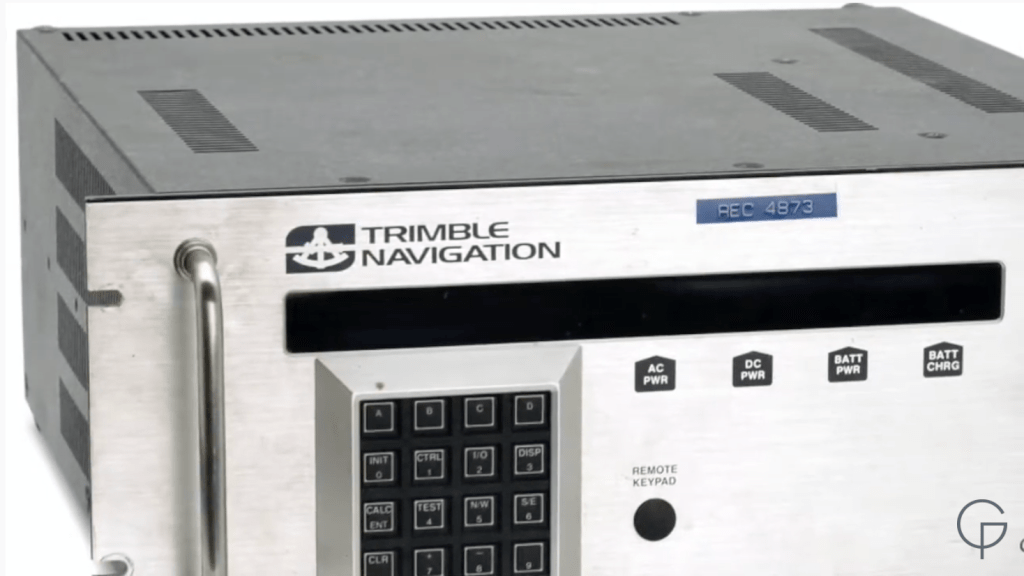
Trimble Navigation 4000SX
Credit: National Maritime Museum, Greenwich, London
The second object was a bit of a cheat, as it was two objects that worked together: a Husky Hunter 16 portable laptop, and a XR4-PC GPS Receiver made by Navstar Systems in 1991. I have to admit, this is one of my favourite objects in the RMG navigation collection.
Working together, this powerful package was one of the very first portable computers in the world to have GPS installed. Imagine how revolutionary it was to be able to take a computer with you to use at sea. Now, add in the ability to know where exactly your position, wow! It was a great advancement for those working on weather ships, doing geological surveys and conducting oceanographic research.
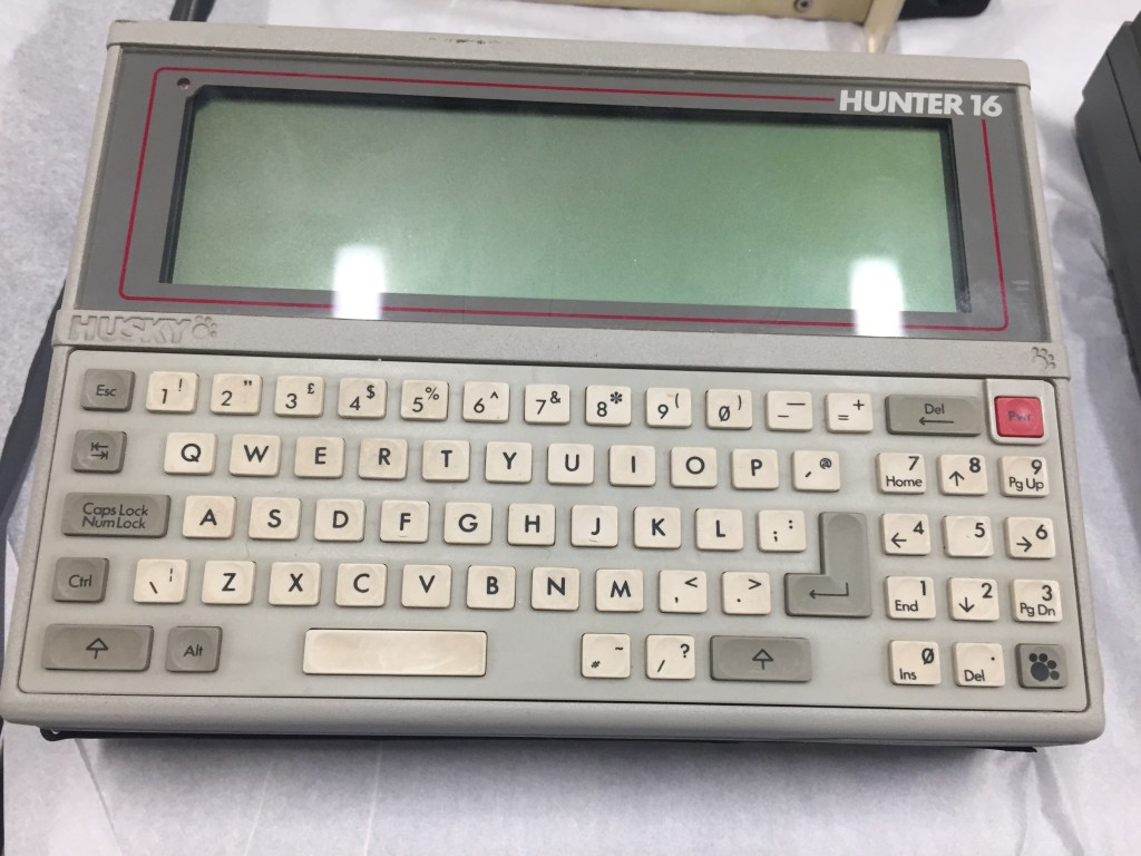
Husky Hunter 16 portable computer
Credit: Intel Corporation and National Maritime Museum, Greenwich, London

This GPS Receiver fit into a portable computer such as the Husky Hunter 16 above
Credit: Intel Corporation and National Maritime Museum, Greenwich, London
These objects may look like ‘old electronic junk’ that is ready to be recycled. But investigate further, and these objects demonstrate how quickly navigational technology changed from the early 1980s to the 1990s – the first mobile phone to be enabled with GPS was sold only a few years later, in 1999. Where would be without it?
These objects also remind us of the early inventors and users of GPS, and how much of the history of GPS happened at sea. It is awesome to think of the power of global satellite navigation systems today – and how GPS transitioned from a technology largely designed to aim nuclear missiles from naval submarines, to a piece of tech we carry around in our pockets.
To find out more about these objects and those talked about by Megan and Marie, watch the Youtube video, or click on the above links to the RMG collection items. Happy travels.

Dear Erika Jones,
your present e-mail address is difficult to find, hence I use this channel. My name is Kees Kramer and I am – also – secretary of HOC, the (originally Dutch) History of Oceanography Club. In addition I edit its newsletter ‘ad HOC’. In the upcoming number – due May 21 – I will include a reference (with link) to your interesting thesis on Challenger, and would like to send you a copy (in pdf format). For this I need the e-mail address.
At the website mentioned in the box below I use the HOC website, for you to further explore (see especially back issues of ‘ad HOC’). Possibly you want to join? No obligations or costs (but text contributions are welcomed).
Best regards, Kees Kramer
LikeLike
Dear Kees Kramer,
Thank you for getting in touch! I apologise for my slow reply – I am a bit behind on checking on the state of my blog.
I will change the settings so that I am notified right away.
Yes, please do send me a PDF of the ‘ad HOC’ newsletter, I would enjoy reading it and finding out more about the organisation. Thanks for including a link to my Challenger thesis – much appreciated!
My email for future correspondence is ejones@rmg.co.uk. Please do get in touch.
All the best,
Erika
LikeLike